Battlefield Guide Services

Wednesday, February 29, 2012

Hospital Burial Site on the Carpenter Farm Located. Wilderness Battlefield. Then and Now...


THEN
     The photograph above is from the series made under the direction of Union Surgeon, Dr. Reed Bontecou in April 1866. It is identified as showing graves of Union dead on the James Carpenter Farm, near the Wilderness Battlefield. Only one grave marker appears to bear a name, that of Sgt. Richard Ross of the 40th New York Infantry. All images are clickable for greater detail.
NOW
     The 40th New York was in the 3rd Division of the 2nd Corps, Army of the Potomac. Utilizing a hand-drawn map of the 2nd Corps hospital site, supplied by NPS Historian Don Pfanz, and assumed to be from the National Archives collection, your blog host was able to place the vicinity of the four divisions on the modern landscape. After studying the topographic features in the area of the 3rd Division, I was able to find the burial location photographed in 1866, still looking very much as it did then. The bodies had been removed prior to 1876 and reinterred in Fredericksburg on Willis Hill, in the National Cemetery. The hospital site is now the home of the Spotsylvania chapter of the Izaak Walton League. 
     In November of 2010, NPS Historian John Hennessy wrote a blog feature on Mysteries and Conundrums, which examined the original photograph. In a comment I submitted to that post, I speculated that the burial site would probably be in the range of 75 yards from the road. The location turned out to be about 112 yards from the main road, but alongside what appeared to be a slight road cut within the property. 
                               Aerial map of the former Carpenter Farm on Herndon Road, near
the Wilderness battlefield, approximately two miles northeast from where
 the 40th was engaged and Sgt. Ross would have been wounded.
I have indicated the area where each division treated their wounded, as
 well as the burial area for the 3rd Division, in the upper right, marked "graves".
Note: This land is PRIVATE PROPERTY, do not trespass.
Seen above is a document from the widow's petition for pension filed by Eliza Ross,
 October 14, 1864. She would receive eight dollars per month. Ross also left
 behind a daughter, Catherine, not yet two years old when her father fell.
The detail above is from the previous document.

The Ross residence, at 36 Pitt St., in New York City, was likely cleared away for construction
 of the Williamsburg Bridge, begun in 1896. The area today, as seen below at the corner of
 Delancey Street South, retains no resemblance to its 19th century appearance.

A close-up detail of the original marker for Sgt. Richard Ross.
Your blog host recently visited the Fredericksburg National Cemetery
 to pay respects at the relocated grave of Sgt. Richard Ross, number 3994.

ROSS, RICHARD. Age 30 years at enlistment. Enlisted in Brooklyn, and mustered in on Oct. 24, 1861, as a Private in Co. H, 87th N. Y. Inf. Transferred, Sept. 6, 1862, to Co. K, 40th N. Y., the Mozart Regiment. Captured on May 2, 1863, at Chancellorsville, and paroled Oct. 9, 1863. Promoted to Sergeant in Co. C, upon re-enlistment as a veteran, Dec. 29, 1863. Wounded in action, May 5, 1864 in the Wilderness, and died of wounds at the Carpenter Farm Hospital site, May 9, 1864. Buried initially on the hospital site and eventually reinterred in the National Cemetery at Fredericksburg, Va.

     The vicinity of the fighting where Sgt. Ross was likely wounded, south of the Orange Plank Road.
 The view looks southwest from the Union position, toward the advance of McGowan's South
 Carolinians, followed, to the viewer's left, by Scales' North Carolinians. 


Monday, February 20, 2012

Gettysburg's "Harvest of Death" correction to post of 2-18-12

Notice: Be sure to go back to the post of a few days previous by clicking here. Incorrect material had been added by your blog host in a premature effort to fill in some blanks. As I point out within the correction, "Haste makes waste."

Many thanks to my friends and loyal readers for keeping me on track. It was a close call.

Stay vigilant!

Sunday, February 19, 2012

Worth A Thousand Words - An Image of Development

This simple stone marker was placed in 1903 by former Confederate staff officer James Power Smith. It marks the location of famed Major John Pelham's daring action, with a single cannon, against advancing Federal forces during the battle of Fredericksburg. The stone once stood more directly placed, along the road, facing the other direction, until moved further into this corner lot due to development pressures. Seen across the intersection is the ground over which the Federal advance came, as well as the challenging fire of over two dozen Union cannon. Pelham and his gun crew held this position for over an hour before finally withdrawing when ammunition was running out.

The portrait of John Pelham at right was taken when he was 16. He was barely three months into his 24th year during the battle of Fredericksburg. Three months later he was mortally wounded at the Battle of Kelly's Ford, Virginia, on March 17, 1863. His body was returned to his home state of Alabama and is buried in the Jacksonville City Cemetery.

Click map to enlarge for greater detail.
The aerial map above shows the Pelham marker site (bottom right) as it sits today among residential and commercial development. The red line indicates the direction of fire from Pelham's cannon as the Union advance of thousands of infantry swept toward the Old Richmond Stage Road, modern day Tidewater Trail, Route 2. Union artillery, situated near the large, white roofed building, returned fire, unable to dislodge the Confederate nuisance. The one acre strip of land running southwest of the marker has been preserved by the Central Virginia Battlefields Trust since 2007. As of this writing, the larger commercial building below the marker sits vacant, the victim of direct competition from rival businesses across the street, directly in the line of Pelham's fire.

Monday, February 13, 2012

Spotsylvania's 23rd USCTs Making the Rounds During Black History Month

The reorganized 23rd United States Colored Troops have had a full schedule thus far during the 2012 Black History Month. Last Saturday, members turned out to present a program at the Germanna Community College, which featured the 23rd's very own Lt. Jimmy Price, speaking on the Battle of New Market Heights. Afterwards, members toured the remains of Confederate entrenchments on the grounds of the College. These works had been featured in a blog post here, on July 11, 2010.

Atop the former Confederate defensive works at Germanna Ford.
From left to right, Regimental Chaplain Hashmel Turner,
 Corporal Steward Henderson, Captain John Cummings,
 and Medical Steward Kevin Williams.

The 23rd's "Abolitionist Senator", James Anderson,
and special guest speaker, Denise Benedetto.

Corporal Henderson answers questions for a reporter on Sunday,
February 12, before a service and presentation on the history of
the 23rd USCTs, at the Bethel Baptist Church near Culpeper, Virginia.
The 23rd's Chaplain, Reverend Hashmel Turner, gave the day's sermon.


You are invited to a CONVERSATION,
Saturday, Feb 25, 2012, at 12 noon.

“Bridging the Chasm: A Public Conversation about Freedom,
 the Civil War, and its Complicated Legacy”

Our Guest Speaker: John Hennessy, Chief Historian
 of the Fredericksburg and Spotsylvania National Military Park
hosted by the
John J. Wright Museum, and the 23rd Regiment United States Colored Troops

7565 Courthouse Rd, Spotsylvania, VA 22551-2706

This event is one of several in the 2012, 23rd Regiment U. S. Colored Troops Lecture Series. It is free and open to the public, and supported in part by a grant from Spotsylvania County Government.
For more information, call (540) 582-7583, ext 5545 or on the web at http://www.jjwmuseum.org/
 
We hope to see you there.


Wednesday, February 8, 2012

Sign, Sign, Everywhere A Sign. Spotsylvania Park Border Signs. A Photo Essay.

Confederate trench, running directly along a southern boundary, below Landrum Ridge.
Notice: Neighboring property is heavily posted at right.

A type of sign-eating tree.

An old, metal boundary marker on a now dead tree.

The neighbors are serious. Read the hand written notation.

Another border marker on a soon to collapse, dead tree.

Yet another sign-eating tree.

They start young back in these woods.

Your blog host, standing on a southeast boundary corner.

An interesting pile in front of the tree at right distance...

Discarded or abused?

A sign once hung here.

Boundary and detailed notice signs share a tree along an eastern border.
Heed the warning! You will be prosecuted.
IT IS UNLAWFUL TO - injure, excavate, or appropriate any historic or prehistoric ruin, monument, object of antiquity or of scientific interest without specific authority by the Secretary of the Interior.

Monday, February 6, 2012

Best Evidence? What do the Gettysburg Harvest of Death Images Show?


In the next few weeks I imagine, historians Garry Adelman and Tim Smith will be posting entries on the Gettysburg Daily blog, to examine and challenge numerous researcher's claims of finding the "Harvest of Death" photograph grouping, including my own, and that of National Park Service historian, Scott Hartwig. Garry has let it be known that he and Tim spent the past weekend at Gettysburg filming video segments for this presentation.

 
Since posting my own examinations, I have found that Scott Hartwig had not only presented his research on the Gettysburg Park's blog in May 2011, but also as an article in the October 2011 issue of Civil War Times Magazine. In the December 2011 issue of Civil War Times, Garry Adelman took Scott to task in a letter to the editor, and asserted that Mr. Hartwig's conclusion was "impossible". Interestingly, within Garry's dissection of Scott's presentation, he lays claim that the Thompson house "does not show up in wider versions of Alexander Gardner's view", something that my own, independent research, shows to be false. The Thompson house, "Lee's Headquarters", does very much appear, right where it should be, atop the ridge, at the upper right hand corner of the image. Faint, not in sharp focus, and apparently fog enshrouded, but nonetheless, there. Likewise, the companion Gardner image, looking to the southwest, is equally plagued by a lack of depth of field. Background elements of this image are blurred and essentially washed out in appearance. Regardless, this image as well, does contain some potential clues as to its location on the field.

Please click on any of the images on this blog for larger examination.
Note, along the horizon, the distant wood lines, as well as the barely
discernible, scattered trees in the field. Theoretically, the Hagerstown
 Road should be running left to right along that southern end of the field. 
The map below shows these elements as they appeared in 1868. 
 

Here, once again, as demonstrated in my prior posts, are horizon
elements that provide a surprisingly similar appearance to the Thompson
house, which has been a point of debate when discussing mine, and Scott
Hartwig's examinations of these images. The Brady photograph below,
from July 1863, taken within weeks of the Gardner/O'Sullivan images,
 shows a strikingly similar appearance to the distant objects captured above.
Hard to consider them coincidence, especially when added to all the other
items of consideration. Garry Adelman considers these similarities of terrain
as, something he has found to be "fairly common" at Gettysburg. I challenge
 that assertion. Yes, there are ridge lines, woodlines, and fences, but not
so coincidentally where they should be in both directions. Remove one
of these elements and there is room to talk. Additional field work is still
needed however. That will happen when the weather cooperates.

Brady's close-up photograph of the Thompson house. How odd
that everything appears to match if it is not the same structure.
One challenge to my theory is that the house appears to be white
instead of a darker stone evident in Brady's shot. It appears lighter,
I maintain, due to whatever atmospheric conditions, such as fog,
appear to make everything in the distance appear lighter and washed out.
There is a distinct lack of depth of field also at work. Further reading
regarding the "science" of this can be read at this link, here.

The full view of the right hand half of Gardner's stereo pair, which in
my theory, looks to the north, showing the wood line on Oak Ridge,
just beyond the unfinished rail cut, and Mrs. Thompson's house in the
upper right hand corner, above the orchard on the ascending slope.
The trees in the middle distance, running parallel with a rail fence line,
also appear in the "Warren" map. Just a coincidence? See below.
Fence line with parallel trees at center, orchard on slope to right,
with the Thompson house just beyond on the Chambersburg Pike.
Everything all added up, places the Harvest of Death below that
fence with the parallel trees. The only remaining issue is to calculate
the exact camera position, its angle and height from the ground. One must
also factor in one hundred and fifty years of erosion, infill and other modifications
 to the bottom between McPherson's Ridge and Seminary Ridge, as it is clearly
 evident that time has taken a toll with the effects of man and nature.
The map detail below, from the old Battlefield Park Commission,
demonstrates encroachment in the area, including a horsedrawn rail line,
and some unidentified feature that looks like a race track. It is
also quite probable that the middle ground was altered to allow
a feeder trench for pond features above and below the Hagerstown Road.

 Further research should reveal these mysteries,
but for now, the surrounding features, to the north and south,
appear to provide evidence that the dead seen in this grouping
are indeed lying in the "Field Where Reynolds Fell", as captioned
by Gardner. There is no concrete evidence to preclude Gardner
was not on the first day's battlefield, merely conjecture, dating back
to the publication of William Frassanito's, Gettysburg: A Journey in Time.

Wednesday, February 1, 2012

New Year - Old Sites: Juxtaposition - Chancellorsville


The Chancellorsville intersection, circa 1900. Photo by John Okie.
Hunting dogs of Thomas P. Payne, a Spotsylvania County deputy
 commissioner of revenue. Image is courtesy of Kathleen Colvin,
Payne's granddaughter. View looks north along the Old Plank Road.

The Chancellorsville intersection, January 1, 2012.

The top image was taken about thirty-seven years after the 1863 battle of Chancellorsville. Life had begun to assume a feeling of normalcy at this once hotly contested intersection. The Chancellor house, which had been destroyed during the fighting, was rebuilt, but would survive just another twenty-seven years until it would be, yet again, consumed by fire.

One hundred and twelve years have gone by since these dogs sniffed about the muddied road, always dutiful, always vigilant. Man's best friend. Tens of thousands of sunrises have crossed the landscape. Inside the house the day-to-day human dramas would unfold. Children would laugh and cry. Words were spoken in love and anger. Joy over births, and sorrow over deaths. The gamut of human emotions lived out within the walls, echoing in the hallways, until they were no more. Gnarled remnants of once great shade trees now sway in the winds. The surrounding fields that had provided generations of crops turned fallow and returned to grassland, yet no cattle graze today.

An eerie silence hangs in the air. The ghosts of over three thousand soldiers, killed near here, bide their time in eternity.


Monday, January 23, 2012

Putting A Face On The Dead: A Wilderness casualty from the National Museum of Health and Medicine

    Let me state up front that I am not trained as a forensic pathologist, but the images I provide here were produced using rudimentary information I have gleaned over time while studying the cranium collection at the National Museum of Health and Medicine, now located in Silver Spring, Maryland.
    The principles of tissue depth, in this case along the median points of the skull, are the building blocks for forensic facial reconstruction. These points: vertex, glabella, naison, rhinion, sub-nasale, labrale superius, labrale inferius, mentolabial sulcus, pogonion, gnation, menton and gonion, provide us with a reasonably reliable, statistically established, method of creating the outline of a deceased's facial profile.
    This then, was an exercise for me, to apply these basics on one of the many skulls collected by Union Surgeon, Dr. Reed B. Bontecou, in April of 1866. Bontecou traveled to the battlefields of Spotsylvania County, shortly before mustering out of the service, with the intent of collecting pathological specimens, specifically the crania of dead Confederate soldiers who's remains had been lying in situ since the battles nearly two and three years prior. The Union dead had been gathered and placed in temporary cemeteries in the summer of 1865. In contrast, many of the fallen southerners had been barely covered by comrades, and their bones bleached in the sun while their uniforms decayed around them. The region had been devastated by the war, and a dramatically reduced local population had yet to make any effort to provide better treatment, especially in such remote areas as the Wilderness.
    This specific individual had received a severe trauma in the vicinity of the left ear, producing a large, fractured hole in the temporal area, but no exit wound. A good number of these skulls in this collection have the deadly projectile which ended their lives accompanying them, usually attached by wire near the entry site. This specimen does not.

NMHM collection # AFIP1000619

Site of the fatal wound. Note extra tooth growing out of left maxilla.

My initial workup over top the right profile photograph, having used
 tissue depth markers to establish the outline of the face.

The base photograph and drawing are reduced to line art.

After removing most of the base photograph and refining the
facial features we are left with what may be a faithful likeness
of this unknown soldier, killed in Spotsylvania, Virginia.

    Of course, we do not know if he had facial hair or precisely what age he was. A more professional working of the specimen can yield many more tell-tale clues to these details. Perhaps one day the funding may become available to the Museum to help put a face on all the unknowns that reside in the drawers of the collection. No matter what the circumstances that brought this man's life to an end, all should be accorded the dignity of recognition as a human being. I hope this may be some encouragement toward that goal.

A photograph taken of human remains during Dr. Bontecou's trip to Spotsylvania County
in April of 1866. Bontecou had a photographic team accompany him on this journey. For
 further information, I will suggest an article I wrote for the March/April 2009 issue of
Civil War Times Magazine, introducing my studies of these images and the route taken
by Bontecou and his entourage. I continue to work on a book length manuscript as well.

    In September 1865, Northern journalist John T. Trowbridge toured the war-torn Spotsylvania region with a local guide, and witnessed the same unburied bodies Dr. Bontecou would find nearly a year later. From his book The South: A Tour of Its Battlefields and Ruined Cities, he describes his macabre encounter in the Wilderness region:

    "And what appalling spectacle is this? In the cover of thick woods, the unburied remains of two soldiers -- two skeletons side by side, two skulls almost touching each other, like the cheeks of sleepers! I came upon them unawares as I picked my way among scrub oak. I knew that scores of such sights could be seen here a few weeks before; but the United States Government had sent to have its unburied dead collected together in the two national cemeteries of the Wilderness; and I hoped the work was faithfully done.
    "They was No'th Carolinians; that's why they didn't bury 'em," said Elijah, after a careful examination of the buttons fallen from the rotted clothing.
    The buttons may have told a true story: North Carolinians they may have been; yet I could not believe this to be the true reason why they had not been decently interred. It must have been that these bodies, and others we found afterwards, were overlooked by the party sent to construct the cemeteries. It was shameful negligence, to say the least.
    The cemetery was nearby -- a little clearing surrounded by a picket fence and comprising seventy trenches, each containing the remains of I know not how many dead. Each trench was marked with a headboard inscribed: "Unknown United States soldier, killed may, 1864."
    Elijah said that the words United States soldiers indicated plainly that it had not been the intention to bury Rebels there. As a grim sarcasm on this neglect, somebody had flung three human skulls over the paling into the cemetery, where they lay blanching among the graves."

Thursday, January 12, 2012

Gettysburg - Harvest of Death - Location Found, January 11, 2012, Confirmed June 14, 2012

REVISION: I have floated the revised analysis I am posting here for several years, but have not, till now, published it on this blog. I stated it publicly in April 2016, on location, in the presence of NPS Historian John Heiser, and numerous other attendees. I am very convinced that the dead seen in these images are members of the 151st Pennsylvania Infantry Regiment. Initially I would have thought them to be the dead of the 24th Michigan, but what I understand now shows me that the Iron Brigade skirted to the north of this location, falling back, past the 151st Pennsylvania who were going to take the brunt of Virginia and North Carolina units pressing through the woods. The 151st Pennsylvania made their stand on the crest, in front of the edge of the woods where Reynolds fell, until falling back across the field bordered by fences to the north and south. This field is the reason why the "Field Where Reynolds Fell" captioning is derived by Gardner. I am officially publishing this revision on 10/12/2018.

Be sure to read the post attached to our February 25, 2013 link. Click here. It further demonstrates this site is located on the first day's field. Clear visual evidence. 

This post has been revised to reflect the corrected findings of my October 6, 2012 return visit.
Be sure to read the October 12, 2012 post on this subject by clicking here. It contains more current information on the location.
Additional information can be found on the June 14, 2012 post by clicking here.


     One of the most elusive group of Civil War battlefield photographs has been the image known as “The Harvest of Death” and its companion images, showing the same bodies from a near opposite angle. The group was made in the days following the battle, most probably July 6, 1863. There have been three prevailing theories as to the precise location of this ghastly scene. Since 1975, historian William A. Frassanito has felt comfortable in his belief that the group of photos was taken somewhere near the Rose Farm and the Emmitsburg Road. The greatest challenge has been in trying to locate a piece of land where all terrain features cooperate, in both directions, to make the theory work. Granted, doing this has been made even that more difficult by over a century’s growth and/or removal  of wood lines and other obstructions, as well as potential modifications to the landscape surface. The mission has continued for another thirty-seven years as numerous investigators have scoured the battlefield landscape to find the right combination of elements.

Gardner caption, "View in field on right wing."
Library of Congress collection.

     In May 2011, Gettysburg National Park Service Historian Scott Hartwig published his own theory, located in an area below the Chambersburg Pike, near McPherson’s Woods that seemed to work, and was much more in keeping with the original captioning of the published images by photographer Alexander Gardner. It runs along the Park Service road, Reynolds Avenue South.

     Most recently, historian Jerry Coates has spent considerable time investigating an area south of Gettysburg, and west of the Emmitsburg Road. This theory stayed more within the confines of the original Frassanito analysis, but was supplemented by a more in depth study of the uniforms the dead are wearing and attempting to use this criteria to narrow down the numerical potential as to who they might have been and thus the field of battle these men would have been engaged on in July 1863. He has come up with very similar terrain and some good arguments.

     However, my own investigative work has concluded that of all these prevailing theories, the one that seems to come the closest is Scott Hartwig’s on the first day’s battlefield. But, although very well founded and assembled with sound judgment, Hartwig’s theorized location has its faults and can be termed with the old expression, “Right church, wrong pew.”

     What all the prevailing theories lacked was a concrete feature or landmark that would anchor the image to an indisputable location. My examination of the series of images has discovered what appears to be that necessary clue. The clue has been available in plain sight to all that have looked at the glass negatives for the stereo pairs, and quite possibly the 8 X 10 glass negative, although that full image is not printed or available online presently by the Library of Congress, but is referred to by William Frassanito and shown in cropped form on page 227 of his Gettysburg: A Journey In Time. In many prints of the image entitled “Field where General Reynolds Fell”, the full image has been cropped and has thus removed the landmark feature. The landmark looks like none other than the residence of Mrs. Mary Thompson, known more famously as “Lee’s Headquarters”. In the upper right hand corner, again invariably cropped out in published formats, the house is easily discernible along the horizon line. It is understandable that it could be easily overlooked as just another shadow in the line of trees, but when magnified, and compared to wartime images of the structure, it becomes more than obvious. In utilizing the Thompson house as the anchor for this image, it becomes far easier to establish a camera position, and thus, possibly prove that Gardner’s original captioning was spot on as to the vicinity of the battlefield.

Is this the home of Mrs. Mary Thompson, "Lee's Headquarters,
as seen in an enlargement of one half of a stereo glass negative?
Annotated copy of the previous enlargement showing key elements.
Find these same elements in the image below for comparison.
All images are clickable for enlarged viewing.
Photograph of Mrs. Thompson's house, attributable to Mathew Brady.
Note the white fence, chimney, and trees on either side of the building compared with
 those features in the enlarged views preceding. Is this the rock solid clue to these images?
Library of Congress collection.

Overlay with Thompson house image by Brady at 75 percent
transparency over top shadows seen in Gardner image, right horizon line.
Brady's street level image was of course taken close up, but even at
464 yards, the shape of the house and surrounding trees is discernible.

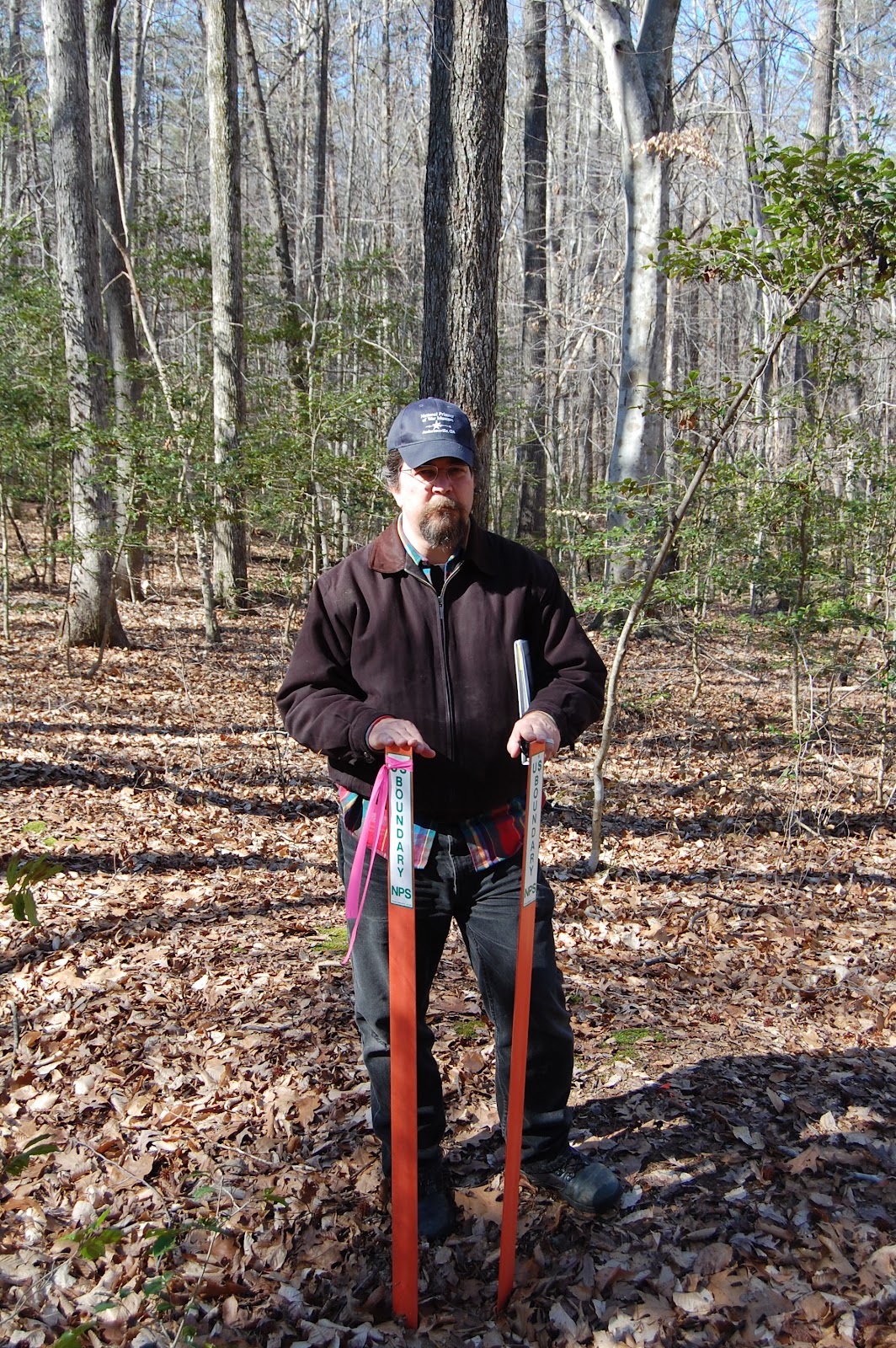
     Two field reconnaissance trips to the Gettysburg field had given me the evidence to support this theory. On November 18, 2011 and January 11, 2012, my investigations concluded that the dead in this series of exposures were likely killed south of the Chambersburg Pike, between McPherson’s Ridge and Seminary Ridge. This section of the field was just below the northernmost of two fence lines that ran parallel to the Pike and enclosed a field that included the Herbst Woods in its western extreme. If so, these men fell approximately 100 yards east of the spot marked where General Reynolds fell, and roughly 460 yards southwest of Mrs. Thompson’s house. The camera location is roughly 290 yards northeast of Scott Hartwig’s theorized conclusion, which was south of the lower enclosing fence, and too far south of the Thompson house to have allowed for the structure to appear as it does in scale along the Chambersburg Pike Ridge. Jerry Coates theoretical location is approximately one and three quarter miles south of the Seminary Ridge killing field.

Gardner's camera position adjusted October 6, 2012 with further corrections October 12.
 Click on this and all images to enlarge.
Green triangles indicate approximate field of view of lens for both images.
Light tan lines indicate approximate war-era fences separating field.

The Gardner image, note the faint Thompson house at upper right, along horizon.


Approximate same view as of October 6, 2012. Thompson house to right of motel complex.
Gardner's "Harvest of Death"
See my September 28, 2012 posting regarding the horizon line and
 apparent doctoring of the image by Alexander Gardner.
Approximate same view as of October 6, 2012.
For questions regarding the horizon line, visit this additional post on the subject.
Initial investigation, and attempt to set up the shot towards the Thompson house.
Seminary Ridge is in the background. November 18, 2011.
 Photo by James Anderson.
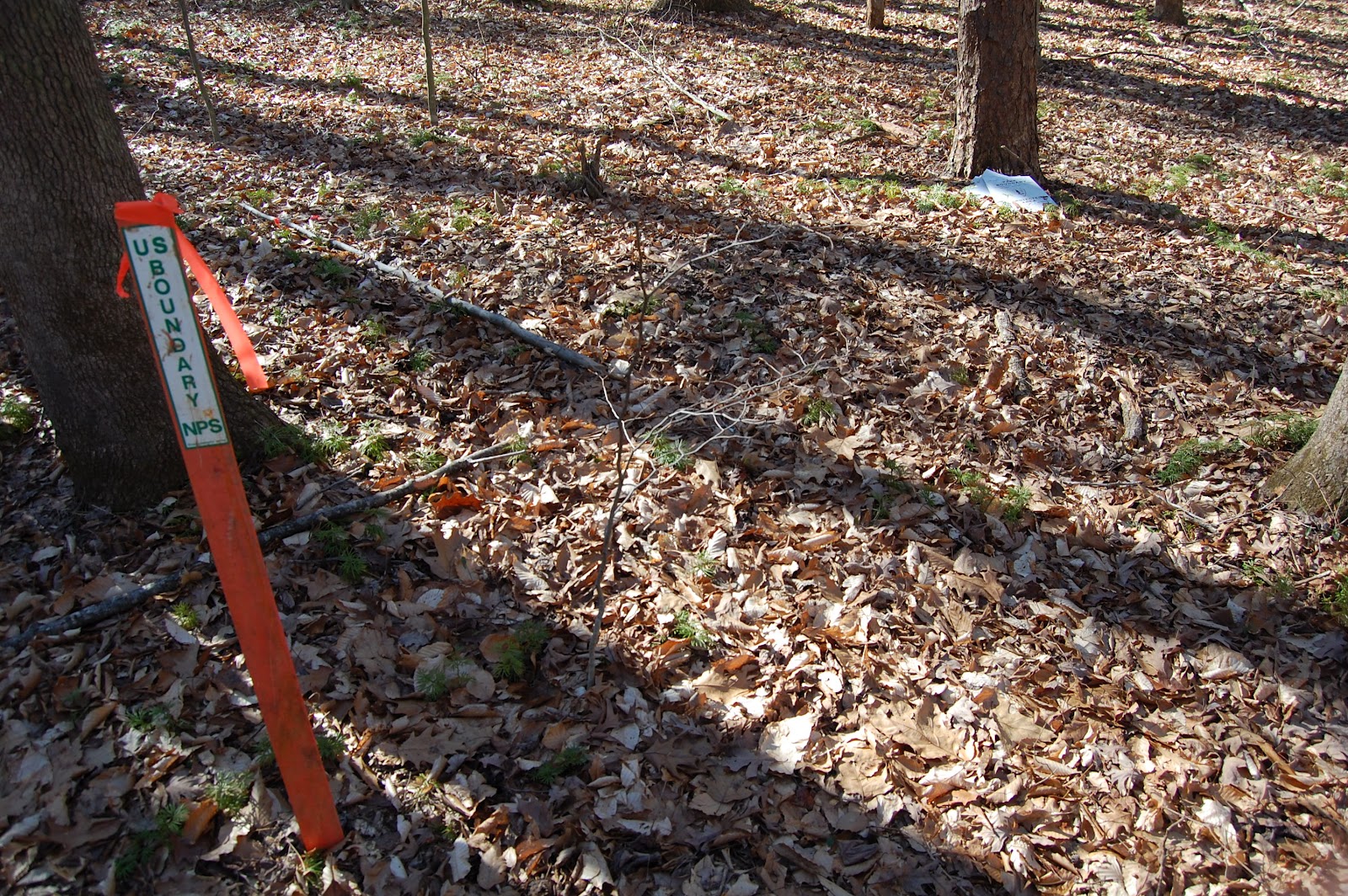
Looking for the correct view toward the Thompson house on November 18, 2011.
Photo by James Anderson

Be sure to visit the June 27, 2012 post
for the complete story
Monument to the 24th Michigan overlooking
Willoughby's Run. January 11, 2012.
These men, and others of the Iron Brigade, exited this area, and fled past the
151st Pennsylvania who would cover their retreat, taking heavy casualties.
Mrs. Thompson's house as it appeared January 11, 2012 with the addition of
dormer windows expanding the second floor. At the time of this photograph
the home served as the Lee's Headquarters Museum.


View of the field from Reynold's Avenue South, June 14, 2012.