
The Civil War Roundtable of Franklin, Virginia , on November 12, 1957, stand posed directly on the Bloody Angle, at the point where the Union line is conjoined with the Confederate parapet. To the left of the group is NPS historian, Ralph Happel, who had served as their guide at the adjacent contact station, not visible in this image. The view is looking east, along the face of the Salient. Note the large cedar tree looming immediately to their backs at right. This photograph is from the archives of the F&SNMP.
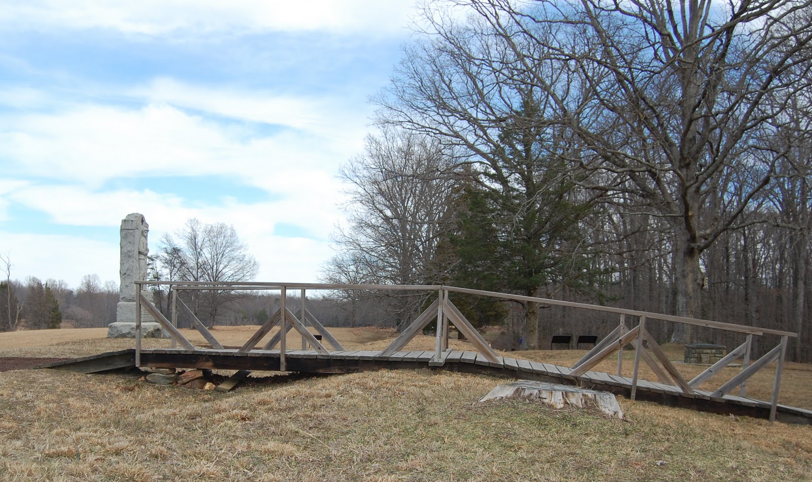
The same spot, fifty-four years later. The Bloody Angle is protected from most intrusive pedestrian incursions by virtue of this wooden bridge, due to be removed at some point in the very near future. Previous posts on this blog, here, here, and here, have covered the construction of a new bridge futher down the line. Note the stump of the large cedar tree at right middle, immediately to this side of the bridge. The cedar was removed a few years ago to help restore the unobscured vista of the Bloody Angle, to that which the soldiers would have experienced. The cedar tree had been planted in the early days of the park as an ill-conceived landscaping measure, one of the conflicts of "battlefield park" versus "natural park" philosophies.

Sparingly placed, so as to to be themselves non intrusive, signs such as these are designed to instill a discipline within the visitor to be mindful of the resource's delicate condition. Sadly, this does escape the consciousness of many, and on a daily basis a casual observer will witness numerous, shocking examples.
The question for the future must now be, "Will the park visitor dutifully follow the new trail system, or will they feel unflinchingly compelled to veer from the path and walk on the earthworks?" The future will tell.
3 comments:
The time I spent at that site last year raised my awareness regarding this issue. Well said, John.
I don't pretend to understand all the issues and criteria that go into the decisions about providing people access to historic battlefields where valuable artifacts like earthworks are involved but I know that it has evolved.
For instance, I think if the Park Service were to start over with a road for vehicular access that they'd likely do it differently since in more than one place they had to have bulldozed some trenches to get it in initially.
I don't know about taking out the older bridge unless a fence or similar is acceptable because people tend to walk shorter distances unless inhibited by something more than "please don't signs".
If you look where the new trail was put in - you'll see that people have been cutting across to the other parallel trail that then turns towards the middle of the field there.
I would assert that that was a predictable thing.... and to be honest.. did not understand when they put the new trail in - why it did not connect with the existing trail (and then rubberize it) rather than run the new rubberized trail parallel to the older, non-rubberized trail.
Like I said.. I'm quite sure I don't understand all the ins and outs that go into the process and decisions...
John: You are right. This is a big issue, one that we will be watching closely. We are going to start with a light touch, and then intensify if we must. But, be assured that we are as intent on preserving these earthworks anyone on earth, and we recognize that a new system (once fully in place, which it is not) is always a risk. We also know you'll keep a close eye on things for us too... John H
Post a Comment