The trail proceeds toward the Bloody Angle and the monuments to the 49th New York and 15th New Jersey.
The trail then continues along the north face of the earthwork for about seventy-five yards, and comes to a sally port in the Confederate line, where a wooden bridge will provide conservation minded passage across, to the inside of the Salient.
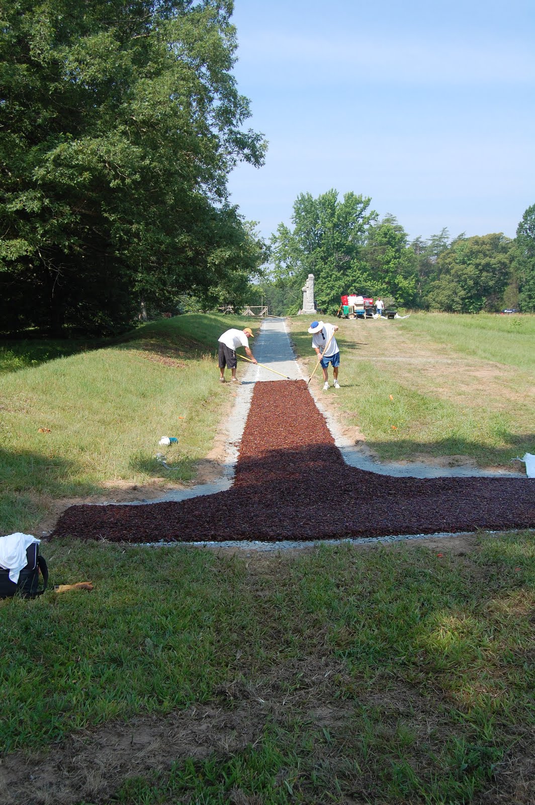
The images below show the construction process of the segment heading up to the monuments from the parking area on Grant Drive.


Begun on Thursday, June 17, 2010, the designated path was marked on the grass with white paint, as seen on top. On Friday, June 18, the foundation for the trail was cut into place with heavy equipment, as seen in the bottom image.


On Monday June 21, and Tuesday, June 22, the trail foundation was further prepared with a base of gravel.

By 4:30 PM, on Wednesday, June 23, the laying of the rubber mulch surface had been completed, and left to cure in the sun. The mulch is made of recycled tires mixed with polyurethane, making a durable path.

The above image shows the construction looking west, along the face of the parapet, toward the monuments.

Here, the gravel bed is put in place.

The mulch mixture is applied, rolled smooth, and left to cure.

By Thursday morning, June 24, the shoulders were refilled and seeded.
In a few weeks, most evidence of the construction process will be hard to detect. Interpretive signage will be stationed along the way. The foot bridge will be put in place to the left of the above image, enabling visitors to pass to the inside of the Salient without damage to the earthworks. The bridge which has been in place near the monuments will be removed, eliminating a long standing intrusion at the Bloody Angle.
Continued progress of this project will be posted at future dates. The picture below is taken from the Bloody Angle, looking east, toward the 15th New Jersey monument, on Thursday, June 24, 2010.

Seen below are the monuments with the parking area at center distance. The trail can be seen as it leads up to the Bloody Angle at the extreme left edge. The old bridge will be removed shortly.

4 comments:
Thanks for keeping us post on the new trail.
John -
Excellent work chronicling the construction of the new trail.
Thanks for your constant attention to this.
- Todd
John --
I'll echo my concerns that I highlighted during my discussion with Mr. Hennessy. This new trail lays on top of the Federal position as those Union soldiers struggled with Rebel soldiers just a few feet away. I sincerely hope the trail makes mention of this fact, instead of only giving the visitor a new "vantage point" to see the Rebel side of the "trench."
Todd
I think the trail takes away from the natural look of the battlefield. It seems to be the opposite of what they are doing at Gettysburg in cutting trees, etc to return the site lines as they were in 1863. How many interprative paths were at Spotsylvania?
Post a Comment