Battlefield Guide Services

Tuesday, August 20, 2013

Additional Thoughts and Images on the McClellan "mystery"

     See my previous post from 8-19-13, for the complete story.

     Further delving into the happenings of March 1862 indicated a strong possibility that the meeting of General Morell with General McClellan took place on March 9 or 10, prior to McClellan moving the army and his headquarters to Fairfax Courthouse.  However, additional information has shown that the image of the General-in-Chief and accompanying officers was copyrighted on January 6, 1862, making the date of its being taken some three months earlier than suspected. Further details are presented in our October 2nd post.  By March, the Peninsula Campaign would be under way. Observation points such as Minor's Hill provided indication of the Confederate withdrawal from the Fairfax and Manassas region.
     Below is a detail from a view said to be the "Miner House". The Library of Congress source states the location is "Petersburg, Va" although a second source in the MOLLUS-Mass collection of the U.S. Army Heritage and Education Center is titled Miner's House, Miner's Hill, Va.  Click on any image for larger viewing.
     Take special note of the dark sign on the wall next to the right hand window, and compare it to the one seen in the image below, at the extreme left of the print from the LOC. That, along with the fence like rail and other features of the building make it doubtless the same structure. Knowing that this is indicated to be the headquarters for General George Morell, we can rule out this is Petersburg altogether since Morell was no longer in a field command position after the Antietam Campaign. Numerous sources state the location is "Miner's Hill", near Falls Church. As stated before, the spelling "Miner" is a common misspelling of the day for "Minor", the name of the property since the late 1700's. The area today includes the Franklin Forest and Franklin Park neighborhoods, near the western Arlington County line.
     The complete view of the Signal Tower is shown below. It is identical to the one in the image with General Morell, and perhaps taken around the same time as the McClellan visit. It is also worth noting in the background of the above image, there are arches decorated with greenery, an ornamentation used in the entrance to company streets in many camp situations. We will see this feature again in another image later.

      Take note of the features of the building visible in the right hand portion of the image below. It is the same structure as above, clearly identified as the Minor House, on Minor's Hill, Va.

     Take note of the decorated arched in the background of the photograph below, depicting the camp of the 17th New York Infantry in review, at Miner's Hill, Virginia, vicinity of Falls Church. Very much like the arches seen in the identified photograph of General George Webb Morell at the Minor's Hill Signal Tower.
     Finally, below, here is the copy from the MOLLUS collection, USAHEC, identified as the Miner House on Miner's Hill, Va., not Petersburg as misidentified with the LOC negative. I see no further doubt that the "mysterious location" of the McClellan image is solved. 


Monday, August 19, 2013

McClellan Mystery: Can we put it to rest? Photo taken at Minor's Hill, March 1862.

     My readers will hopefully excuse this wandering off the path regarding Spotsylvania and it's surrounding engagements. Today's post is a quick trek up the road, north to my old neighborhood, so to speak. The outskirts of Washington, D.C.
     I believe this post will correct one misconception regarding the first attached image, and secondly, solve an ongoing mystery.  The mystery involves the very obvious visage of General McClellan. All indications appear to point to an identification of it's location as being "Minor's Hill", roughly two miles north of Falls Church, Virginia, during a visit to the headquarters of Brigadier General George Webb Morell, a division commander of the Union V Corps. The problem in identification has in places suggested that the man to the left of McClellan, with knuckles also on the stump, is General George Gordon Meade. This man is indeed similar to Meade, but there is a lack of Meade's trademark comb over and the absence of Meade's distinct tortoise eyes. The brigadier general seen here is in fact George Morell, and is so identified on this version. Click on any image for larger viewing.


     Notice the man behind Morell, standing with his arms folded. He is identified in this version of the image as "Surgeon Walters" Notice then in the image below, the man pointing at center is identified as General Morell, this time wearing his cap. Look now, two men to the right of Morell, and you will see Surgeon Walters, again, with his arms folded. Both images are in the Library of Congress collection, identified as Minor's Hill, although misspelled as "Miner's". This location was a large camp and observation area for the Union Army, as well as the location of numerous hot-air balloon ascents to observe Confederate movements to the west. The date for these images is apparently in March of 1862 while McClellan was headquartered at Fairfax Courthouse, roughly 9.25 miles to the southwest. (See update in our October 2 post by clicking here.) The structure seen in each image may in fact be the same. Notice the large observation tower that is known to have stood at this location. The location today is somewhere along the Fairfax County and Arlington County line, amongst wooded subdivisions, with no indication of identifiable cultural resources to pinpoint the exact spot, although chances are the tower was placed on the highest point on the hill. 
Updated August 2016
Exact location found. Structure to be demolished for new homes.


Links to the LOC for each image are located here, and here.

Monday, July 1, 2013

Podcast: The Battlefield Photography of Dr. Reed B. Bontecou

     Earlier in the year I gave a talk on the post-war battlefield photography of Union Surgeon, Dr. Reed Brockway Bontecou, in Charlottesville, Virginia. This is material I have been working on since 2004, revealing the origins of a stereoview series previously credited to a mysterious Baltimore photographer, G. O. Brown. Click the link to listen to a podcast recording made that evening. 
link - The Battlefield Photography of Dr. Reed B. Bontecou
There is an audio flaw at 12:36 minutes into the program. Not certain what happened there.
Below are a few of the images discussed during the presentation.
Click on the images for larger viewing.

     One of eight images of Dr. Bontecou within the series. Detail from a stereo card in the collection of Robin Stanford, with permission. Bontecou is standing in front of Confederate breastworks near the Orange Plank Road.
A later, published portrait of Dr. Bontecou for comparison purposes. Note the distinctive beard.

The sign on the "hacked and barkless trunk". Note the bullet holes peppering the surface.
April 1866.

The detail from the left horizon line revealing the McCoull House on the Spotsylvania Battlefield.
The discovery of the structure in the image was vital to locating the series on the ground
The other view of the same sign and tree creating the triangulation that helped locate the original camera positions. April 1866.

The same view today, showing the earthen parapet extensively eroded.

One of the "G. O. Brown" stereoviews, showing skeletal remains in the Wilderness. April 1866.
Collection of the author.

Shallow graves of dead Confederate soldiers beside the Orange Plank Road.
April 1866. The skull at center resides in the Armed Forces Museum of Pathology Collection,


Monday, June 10, 2013

Brandy Station 150th Anniversary, June 9, 2013

     One hundred and fifty years ago yesterday, over 17 thousand horsemen clashed near Culpeper, Virginia at Brandy Station, on the Orange and Alexandria Railroad. This would result in a day long struggle, becoming the largest cavalry engagement on the western hemisphere, leaving 1,430 killed, wounded, missing, and captured. Above, the view looks northwest, toward the site of the 12th Virginia Cavalry's advance against the right flank of the 6th Pennsylvania Cavalry. Click on this, and any image for a larger examination.
The 6th Pennsylvania Cavalry charges across the open field towards Confederate artillery massed near Saint James Church. From a newspaper sketch by Alfred Waud, in the July 4, 1863 issue of Harper's Weekly. The entire issue can be examined visiting a link by clicking here.
      That field is today preserved thanks to Herculean efforts by preservation groups, thwarting such insensitive encroachments as the construction of a proposed Formula One race track.
The site of the Saint James Church, dismantled by Union soldiers
 for building materials during the winter encampment after Gettysburg. 
Site of the left flank of Confederate artillery positioned on the Saint James Church ridge, looking east.
The only historical marker on the battlefield prior to advances by battlefield preservationists.
 Twenty-three years earlier, in June 1990, Brian Pohanka spoke at a Brandy Station Foundation rally on Fleetwood Hill. Seen in the left background, in the red stripe blouse, is preservationist Annie Snyder of Manassas battlefield fame. Both are now departed, but the battle for hallowed ground continues.
The Henry Miller House, on Fleetwood Hill. Here seen as Union 3rd Corps headquarters in 
the spring of 1863. Notice the large patches of  snow still visible on the ground.
     Fleetwood Hill today. The focus of a current fund raising campaign by the Civil War Trust. The Miller house stood just to the left of the modern structure, based on Civil War era maps. Confederate General Jeb Stuart maintained his headquarters on the lawn, just to the right of the modern house. 
     "Farley", the home of Dr. William Welford, situated on the northwest extreme of the battlefield. Virginia cavalrymen swept across the property late in the day, pressing  a weary Union force back toward the Rappahanock River crossing at Beverly's Ford. During the winter of 1863/1864, Union Sixth Corps commander, John Sedgwick made his headquarters here. It was photographed in March 1864.
 Image from the collection of the Library of Congress Prints and Photographs Division.
Today, Farley has been beautifully restored and is maintained as a private residence.
General John Sedgwick stands at front center with members of his staff. Photographed March 1864.
Image from the collection of the Library of Congress Prints and Photographs Division.
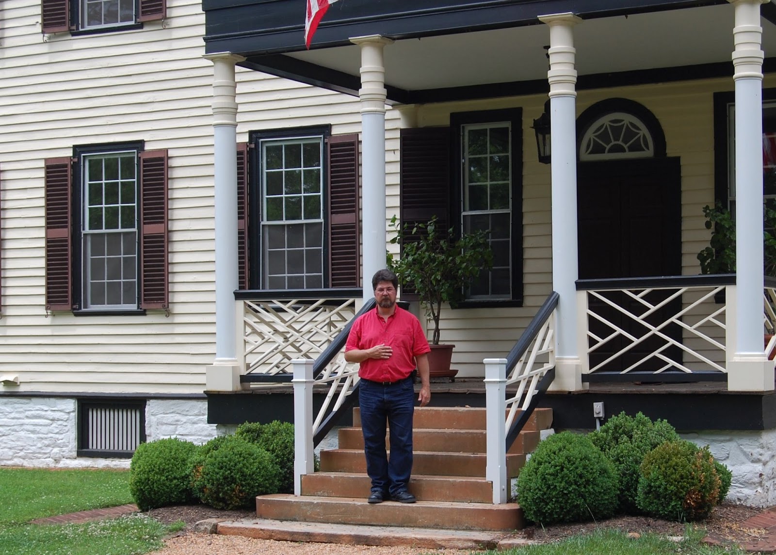
     Now, 222 years old, Farley maintains all of its grand character. Here your blog host strikes a pose in memory of General Sedgwick who lost his life on May 9, 1864 during the battle of Spotsylvania Court House, just two months after the previous photograph was taken..
 On the east lawn of Farley, Sixth Corps staff officers gathered in front of a temporary winter hut.
                 Image from the collection of the Library of Congress Prints and Photographs Division.
     The same view as it appears today. The armies have gone, and peace is on the land.

Wednesday, June 5, 2013

Harvest of Death - The Question of Stereo Card #242 - The False Horizon Tree Line

      July 6th will be here before you know it, and with it will come the 150th anniversary of the taking of the famed "A Harvest of Death" and its stereo companion version, #242 from Alexander Gardner's catalog: "Evidence of how severe the contest had been on the right at the Battle of Gettysburg."
      Below, is a full print from the original glass negative in the collection of the Library of Congress. "242" is scratched in the center, along the line of the septum that separated the two lenses in the body of the camera. This negative is what would have been used to create the two 3" X 3" prints for the stereo card Gardner offered. The current condition of the negative shows both damage from poor storage conditions, as well as emulsion deterioration, and a large, white area along the top of the right hand side when prints are made from it.
      The overall poor quality of the negative left Gardner with a sub-par image, one that probably limited his production and sales of stereo card #242. It is odd that he would have continued to offer the card. In my research, I have found only two (updated) published copies of the card, and its visual quality does leave much to be desired. I will include this image later in the posting, as we discuss the false impression of a distant tree line. In preparation for this blog installment, I consulted with my good friend, and expert wet plate photographer, Robert Szabo. Bob had suggested that what I initially had thought to be an overexposure of this area was most likely created by a paper masking material. In an effort to salvage what he could, it is evident that Gardner created the paper mask to maximize the appearance of a horizon line, and create a white sky whereas the overall result without the masking would have contained little contrast from the main subject matter. This has been confirmed by a physical examination of the original negative in the Library of Congress collection, thanks to the assistance of the Curator of Photography, Carol Johnson. Paper masking, and/or the application of opaque materials to block undesirable elements, was not an uncommon practice.  Let's look at the right side of the negative in greater detail below.
      Note the edge created by the masking, indicated by the downward arrow. The other arrows point to specific flaws of, and on, the emulsion surface. They show cracking in the emulsion, either from improper pouring of the collodian, application of varnish, and/or moisture damage over time. One spot creates a blemish that prints white, as if by an opaque material that got on the surface sometime after initial prints were produced. A trimmed albumen print of this right side is shown below. Note how the horizon line and sky are washed out. Also note the blemishes caused by the damaged emulsion, one just under the legs of the far left figure, and the other, extending horizontal from the hand of the far right figure, exactly where the blemishes appear on the negative, proving the print was made from this negative. We will revisit these blemishes and their cause, later in this posting. Click on any of these images for closer inspection. Print from the Library of Congress, Prints and Photographs Collection.
      Below, another version made from the same negative, with a longer exposure during the printing out process. Note the streaks evident through the emulsion, probably created in the developing process of the negative. The image is stronger, with greater detail, but it does show, even more, the poor quality of the original negative. We also begin to see a false horizon line created by the paper masking.
     Below is the only known copy of the published stereo view that I have found, brought to my attention by Garry Adelman in August of 2012. Garry believed that this provided proof that its visible horizon line was the same as the full plate version, and thus disproved my earlier assertion that the upper third of the full plate print was an artistic contrivance. The link to that posting can be found by clicking here. However, as we see here, the right half of the negative, mounted to the left when published to create the stereo effect, does present the false horizon line, created by the masking. This is clearly an effort by Gardner to make his stereo version appear similar to the full plate version. We can also see how poor the overall image is compared to the beautiful and contrasting images otherwise produced by Gardner. Image courtesy of Garry Adelman.
     To illustrate how the two sides are exchanged, right to left and left to right, I have cropped and moved the  image of the LOC print below, also reversing it to appear as a negative.
     Below is a further cropping, presented as a positive, of the two sides closely approximating the hand trimmed prints on the published stereo view. The white arrow on the left side points to the line created by the masking. Note the dark area to the right of center, as well as the extreme right. Click on the images for larger viewing. Compare that to the published card, leaving no doubt that  this is indeed the original negative used to create catalog # 242. This also proves that the white blemishes damaged the negative at a point after the intitial 1863 publication of the stereo card.
   Below, I have sized the published images to compare to the negatives above. Courtesy Garry Adelman.
Below, I have upped the contrast of the LOC images to provide greater detail, both as a positive, and negative. The blemishes compare to those on the more contrasting print seen earlier. 

Below, the actual glass negative for #242, shown emulsion side down. The masking is applied to the non emulsion side. Photo courtesy of Carol Johnson, Curator of Photography, Library of Congress.
Below, the original negative for # 242, shown emulsion side up. Photo courtesy of Carol Johnson, Curator of Photography, Library of Congress.
Below, a close up of the paper masking material glued to the original negative. Photo courtesy of Carol Johnson, Curator of Photography, Library of Congress.
 Below, a close up of orange staining of the emulsion surface which create the white blemishes on the positve prints. Photo courtesy of Carol Johnson, Curator of Photography, Library of Congress.
     As discussed in previous posts, we can now see that unexplained issues plagued Gardner and his crew during the production of the southward images, both full plate and stereo, during the July 6 shooting of the "Harvest of Death" series. In both instances, perhaps direct sun, and possible chemistry issues, the horizon and sky would not photograph appreciably, something that did not occur  when photographing the same bodies in the near opposite direction, creating the image, "Field Where General Reynolds Fell", as seen in the prior posting available by clicking here.

     Above, the full plate version of "Harvest of Death" with the extensive mimicking of the false horizon line. The artistic modification of the upper third of the image has been detailed previously in this blog at the following link: click here.

The actual location and true horizon line as seen in October of 2012, along Reynolds Avenue South.
Further details from my prior on-site investigation can be found at the following link: click here.


Here's a bonus I'll add, another copy of #242, this one from the New York Historical Society collection. Still problematic, and clearly made from the poor negative. Added 4/25/17.


Wednesday, May 8, 2013

The Imprint of Human Experience and the Juxtaposition of Place and Time. Back to the Future.

     Behind a Charles Street warehouse, Fredericksburg, Virginia. Wounded soldiers of the Union Sixth Corps, May 20, 1864. Obstructions at the location today severely limit the scope of a then and now comparison, thus the radical degree of cropping from the original exposure, seen below, by James Gardner.
     Below, taken diagonally northeast across a former courtyard from the above scene, the Fredericksburg Baptist Church on Princess Anne Street. The courtyard today serves as a parking lot for local merchants. This composite photograph illustrates a car occupying this precise location, seemingly drawing the attention of the 1864 onlookers. What an experience that would be. Where is Marty McFly?