Battlefield Guide Services

Friday, January 1, 2016

The Battlefield of First Manassas - Then and Now, Isolating the Details, and Camera Location

     This post contains REVISIONS, based on continued examinations of the ground on March 31, 2018. These revisions are made to clarify and correct certain aspects that were made two years previous. The chief factor that lead to these corrections was the mowing of a field covered with five foot grass. The tall grass was an unfortunate obstacle that caused a misperception as to the camera position assumed in March of 1862. The misperception did, however lend itself to a better understanding of the terrain beyond the ravine seen running across the middle ground of the photograph. This did enable certain features to be identified in their present condition, and better understand the visual aspect of the fighting on July 21, 1861. I would like to thank Keith Knoke who patiently discussed with me my errors prior to a return visit to the site. The important correction is the confirmation of the original camera position, which was indeed some 140 yards straight back from the position I utilized, as originally determined by Keith Knokes and James Burgess. 

     The camera location for this March 1862 photograph by Barnard and Gibson had been speculated on for many years, and in the March/April 2004 issue of Military Images Magazine it was examined by historians Keith Knoke and James Burgess. Their work correctly placed it along a former fence line on the Robinson Farm, overlooking Henry House and the ground to its east. In October of 2015, The Center for Civil War Photography ventured to Manassas for its annual seminar, taking their attendees along the same tree/fence line, to a similar location selected by the group's vice president, Garry Adelman, and published previously in his 2011 book, Manassas Battlefields Then and Now. In December of 2015, the National Park Service installed numerous new interpretive signs throughout the Manassas National Battlefield Park, including one based on the work of Knoke and Burgess, but located some what off because of obstructing trees. Bottom line, for all intents and purposes, it is the correct camera location, give or take a few feet, here or there. 
     Beginning on October 29, 2015, and concluding on December 4, I began my own investigations of the site, with the initial intention of duplicating the necessary elevation of the camera suggested by Knoke, Burgess, and Adelman, a height all had postulated was made by the Barnard and Gibson camera being placed on the roof of a barn or similar structure. My idea was to work along the fence line, beginning at the furthest southeast corner of the suggested Robinson fence, and make adjustments as I went. It was easy, going into the project, to automatically assume the fence seen in the foreground of the original stereoview was indeed the same site found today, just as my predecessors had done. Start with what seems to be the obvious. However, even with mounting fences, and using my fully extended tripod as a pole mount for my camera, the topography of the ground got in the way, all along the line, in varying degrees of obstruction. The one solid detail in the image, without a doubt, and agreed on by all, was the ruins of the Henry House, anchoring the right horizon line. The foreground fence, and seeming orchard, were problematic, as period maps of the battlefield certainly suggested it should be the Robinson fence, but at the time of my examination extremely tall grass obstructed the view,  causing confusion as to the foreground of the 1862 image, and compelling me to move forward to the next rise, approximately 140 yards further south. This location provided a much more realistic view of the ravine-like feature that runs through the middle ground of the 1862 image. There are only finite possibilities when dealing with this image when accounting for the angle with which we see the Henry House chimney, and the clearly defined topographic features of the ground beyond the ravine. One realization from my March 2018 return visit is that the cluster of trees seen in the left middle ground, are indeed very probable witness trees or their descendants. That is a happy realization, and one that correlates to another image take from the opposite direction in the 1880s for the Century Magazine's article series, Battles and Leaders

     Then and Now comparison of the far side of the ravine. Extremely tall grass obstructs all of the foreground in the modern view. This modern view is taken roughly 140 yards further south than the 1862 camera position, however it does allow for vivid comparisons of the terrain features beyond the ravine. The following three details, both period and modern, are crops taken from a direct overlay of the two, resulting in remarkable matching.

Detail 1
    Zoom in detail of the Henry House ruins. Notice the topographic features still visible today, below.
Scaling was based on an 8 ft approximate height for the chimney base and toppled framing timbers.

Detail 2
Zoom in detail of the ground occupied by Rickett's Battery. The topographic features remain, below. 

Detail 3
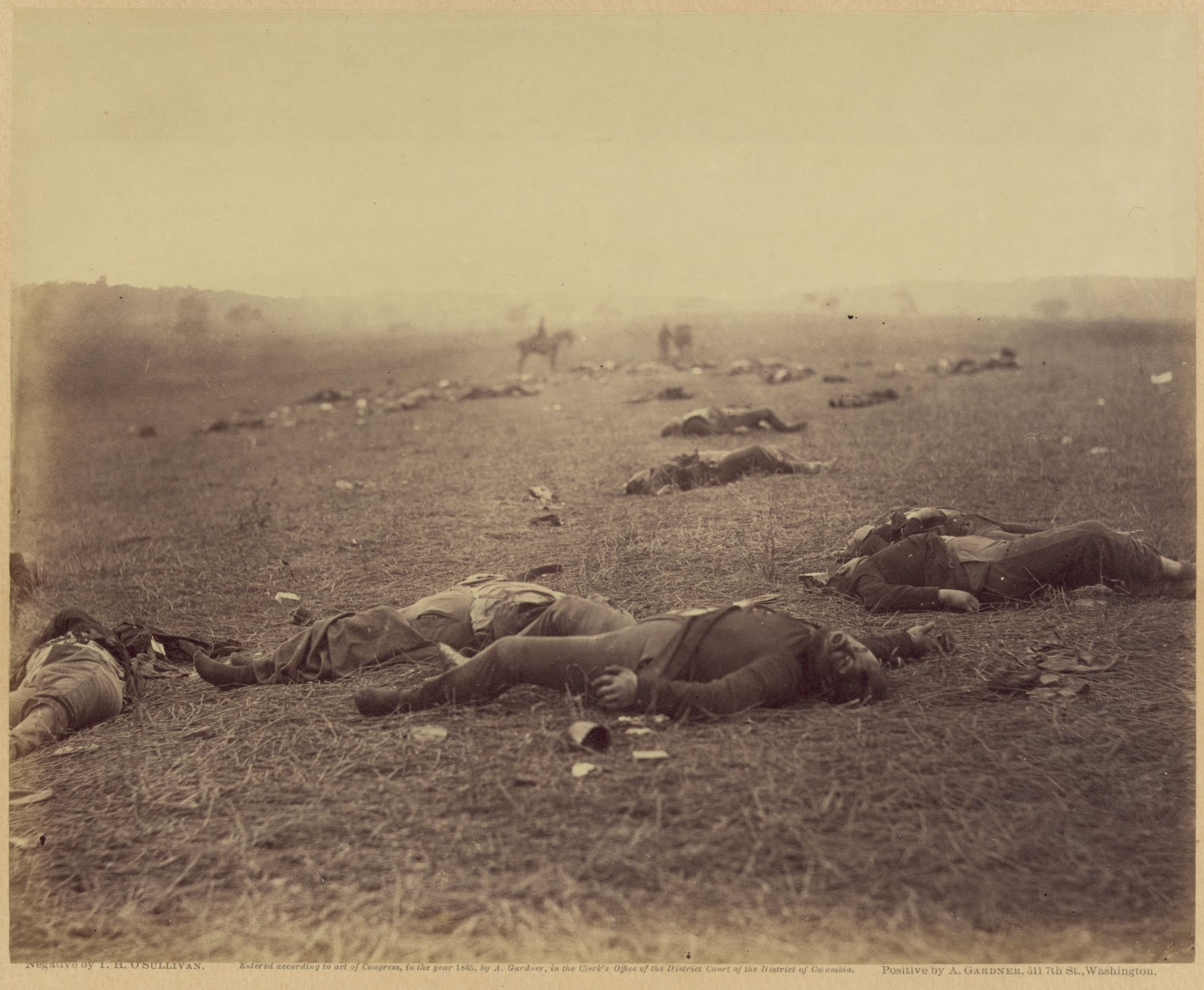
    The Bartow marker location at left of center, along the documented fence running toward the modern Visitor Center, as seen below. Notice the small white objects in the period detail, near where the base of the original monument sits today, wedged between two small trees. These are in all likelihood the scattered pieces of the monument, (the largest possibly being the base itself) having been broken up not long before by Union soldiers, and documented by one who witnessed the incident, in a letter to a friend, and linked here:  On one part of the field I saw a monument erected by Beauregard to the memory of a rebel general. On it was the following inscription, “Boys, they have killed me, but don’t give up the fight.” At the time I saw it, it was standing & whole, but after a short time, I saw that it had been torn down & the boys were busily at work smashing it in pieces for mementoes. 

 The CCWP/ Adelman suggested site, based on Knoke and Burgess, and revisited March 31, 2018, after tall grass had been removed. The topography does not work, as it is too far to the west along the Robinson fence line. It is uncertain why they chose this location for their 2015 Seminar stop.
The new MNBP wayside marker, based on Knoke and Burgess. Slightly off, per Keith Knoke due to tree obstruction, but close enough for this purpose.
Full frame of my originally suggested camera location, December 2015, however the tall grass made the foreground perception difficult. Elevated camera height is approximately nine feet. 
Grass in foreground, to beyond ravine, is extremely tall, more than five feet in some areas.

     March 2018. My corrected view from near what would have been the 1862 camera position, roughly 140 yards further north than my initial efforts in December 2015, and slightly east of the NPS marker. Barnard and Gibson would have to have been on top of a Robinson Farm outbuilding to have achieved the middle ground details seen in their March 1862 view, as well as the downward angle perspective on the fence, an effect I attempted to achieve by raising my tripod above me.

The author, working on the site, elevating camera, December 2015. Photo by James Anderson.

     This engraving from Battles and Leaders, taken from an 1880s photograph, looks from the fields of the Henry Farm, looking northward, toward Robinson, seen in the middle distance. It is possible that the furthest left structure was utilized by Barnard and Gibson to get the elevation needed for their March 1862 view. 
     The cluster of trees seen at far left, above the ravine line, are the same trees seen in the middle left of  the Barnard and Gibson view, but here twenty some years after the battle.


All original contents copyright 2016 and 2018 by John F. Cummings III

Wednesday, November 4, 2015

Gettysburg - Field Where Reynolds Fell - Stereoview Then and Now, and more...

     I am now two weeks away from the fourth anniversary of my initial investigations into the location of Gettysburg's "Harvest of Death", and "Field Where Reynolds Fell" photo series. Over the four years I have made some early adjustments as to the camera position on the field, but have not wavered from the one key element of my work, that the Thompson House is sitting in the upper right horizon of the O'Sullivan view titled, "Gettysburg, Pa. Bodies of Federal soldiers, killed on July 1, near the McPherson woods". This has been fought tooth and nail by the Center for Civil War Photography's co-founder and vice-president, Garry Adelman. In late October this year, he showed a giant anaglyph of the "Federal dead on the right of the Federal lines, killed on July 1" variation, taken by James Gibson, while telling a walking tour he was conducting about the "importance of seeing these images in stereo" when attempting to find their location. Yes, yes indeed Garry, it is vital. Below, I provide stereo pairings from the original O'Sullivan negatives, and a modern stereo pair I made in September. I don't make anaglyphs so pull out your real viewers, such as those issued with the first two Bob Zeller books, or old CCWP seminars, and take a look. Click on the images to see them in larger format as well, especially if the right hand column of this blog interferes with your viewing from the home page.
Get your viewers ready!


     If you are new to all this hubbub, take time to review some of the more recent postings I have made here, especially the ones featuring videos with overlays. Please read my dissection of the actual Harvest of Death photograph companion image as well. In four years I have provided plenty of evidence that the location is found, yet the steadfast denials still spill forth. How many supposed coincidences of "similar ground" but not "the" place can be asserted before it gets ridiculous? All the logic in the world, and the topographic evidence, along with the ORIGINAL CAPTIONING for Pete's sake! Let's see where this goes! 


Here is a little video to lay out the location of this series. Enjoy.


Monday, October 5, 2015

Gettysburg - Harvest of Death, etc debate - More Details... A quick post with video


    Just a quick post, with a video using the Gibson exposure of the view looking to the northeast.
The video points out many of the finer details the photograph shows, and how they relate to today's landscape. The video explains everything regarding the images. Watch the video in full screen.


Click on the photos below for larger viewing.

Detail from Gibson exposure.

Detail from Elliott map with mass Union Burial at left (HoD),
and additional details explained in video.

Overlay detail using O'Sullivan exposure.


Thursday, October 1, 2015

Gettysburg - Harvest of Death and Field Where Reynolds Fell - Time to stop the debate


     Next month, on November 18, I will mark the fourth anniversary of my investigations into the Harvest of Death/Field Where General Reynolds Fell photos. My adventure began as support to the work of historian Scott Hartwig who had published his findings initially on the Gettysburg, NPS Blog, and later in the magazine, Civil War Times. Hartwig's work was immediately met with resistance by Garry Adelman of the Center For Civil War Photography. Adelman's position was that William A. Frassanito had discounted the site years before. Adelman proceeded to produce a thirteen part dissection of where the Harvest of Death was not, demonstrating numerous past proposals by himself and other investigators, include Mr. Hartwig and my own. That series appeared over several months on the Gettysburg Daily Blog. The episodes concerning my work were filmed on February 5 and 15 of 2012, but were not posted until May, months after my continuing work had been adjusted and fine tuned. Nowhere in this time (or since) was Mr. Adelman welcoming to my offers of meeting with him and actually presenting my material in person, something that I had assumed courtesy would permit. Thus, when posted, Adelman's refutations of my work featured a site long out of line with the ground I had settled on, and he has since adamantly stated that the true location will "never be found". Certain circles consider Mr. Adelman's word to be sacrosanct. This has recently led others to offer wide ranging proposals of the "true" location of the Harvest of Death, making it the obsessively desired, "Tut's Tomb", of Civil War photography.

    The foundation of my work has always been based on what I have stated to be a long visible clue in the upper right hand corner of Timothy O'Sullivan's exposure, titled by Gardner, "Field where General Reynolds Fell". It has been consistently my assertion, over many blog postings and other writings, that the features on the horizon are the Thompson House, and the Dustman House. The Dustman House no longer stands, but appears in other photographs, so we know what it looked like, and we know exactly where it stood. The Thompson House, of course, remains today as the site of Lee's Headquarters, on Chambersburg Pike, and is soon to be restored by the Civil War Trust.

     I will not repeat my previous material, as it stands on its own and is easily found by searching this blog, but I will present two brief videos made after a recent return trip to the site on September 25th. Here I demonstrate, using overlays, that the landscape just east of the Reynolds death marker, along Reynolds Avenue, is, clearly, the location of the bodies seen in the July 1863 images.

     What I continue to find sad about the deniers of this site, is that when I visited the location on the 150th anniversary of Gardner's team's visit, my wife and I, and fellow blogger Scott Manning, were the only people there to recognize the dead and the ground they fell on. Scott's coverage of that day can be found here. This is what we do our research for in the end, so that these honored dead can be appreciably recognized for where they fought and died, and hopefully we can achieve a better understand of the battlefield.

     Below, the first video shows the full, left hand side of Timothy O'Sullivan's stereo negative, with my toggling back and forth between the period and modern images, pointing out important features.
View the videos in full screen.


Below, I have zoomed in for a closer view of the horizon features as well as the contoured land between. As mention in the previous video, James Anderson stands in the modern image along the location of the northern fence that enclosed the "Field Where General Reynolds Fell".

Below, are three progressive views of the overlay used in the videos.


Below, my October 2012 map of the camera's field of view, indicated in bright green.

Below, a close up of the area where the northern fence enclosed the field.
The beginning and ending points of the path taken by James Anderson for 
the September 25, 2015 photo used in the overlay video, are marked "A" and "B".
The approximate point at which he is stopped along the way is marked by "J"
This image is not made from the above map, and shows notation lines of other points
 not discussed in this presentation.

For four years I have not wavered in my assertion we are seeing the Thompson House on the horizon. It is the vital clue to anchoring the location. The evidence speaks for itself.

ADDED
Since last night's posting, I am adding these of the opposite view for those who have not read my previous material. Please, examine my numerous prior posts, Enter "Harvest of Death"in the search box near the top of the right hand column. There is plenty to see.


Thursday, August 27, 2015

172 Year Old Witness to Battle of Fredericksburg - Destroyed 8/27/15

     One of the last remaining pre-Civil War structures along lower Sophia Street in downtown Fredericksburg, Virginia, has succumb to years of neglect with an as of yet unspecified plan for the property. Initial efforts to preserve the 1843 structure were foiled the day before when removal of a later addition on the north face of 401 Sophia Street revealed severe termite damage, making any thought of restoration unfeasible.

     The building can be seen in several war era photographs of Fredericksburg taken from the Stafford County side of the Rappahannock River.

     National Park Service chief-historian, John Hennessy, wrote of the pending threat four years ago in the F&SNMP's blog, Mysteries and Conundrums.

     Update! It has now come out that University of Mary Washington students and faculty, of the Historic Preservation Department, were scheduled to document the structure on Saturday, August 29, but the "owners opted not to wait even that long."

     Below are details from period photographs along with photos and a link for a video taken the morning of the demolition.

 Images circa 1863-1864, F&SNMP, and Library of Congress
Prints and Photographs Division. Looking west, from the river.
Above, one of the last photographs taken of the river face of the building, looking west, at 8:37 AM, 
August 27, 2015. Remains of additions to the north face of the building are visible to the right,
 and foreground. The photos below were taken between 8:14 and 9:15 AM, 
 View from Sophia Street, looking southeast.

 Looking north on Sophia Street
 Looking southeast on Sophia Street.


 Visible termite damage of 1843 framework.
 North wall foundation exposed.


Looking northeast from Sophia Street.

 Above, Steve Smallwood, Deputy Director of Building Services Division for the City of Fredericksburg, and Erik Nelson, Senior Planner of the Fredericksburg City Planning Department, along with members of the demolition crew from Abby Construction, examine architectural elements from the debris. Below, an original roof truss and details of its construction.


Salvaged foundation stones and an oak beam from 401 Sophia Street.

Tuesday, June 30, 2015

Iconic Photograph of Gettysburg Dead is a Contrivance A Harvest of Death - Gardner's Artistry


     Tomorrow is the 152nd anniversary of the death of the men seen in this photograph, taken by Timothy O'Sullivan, and published by Alexander Gardner. This is the image that has caused countless clamorings, as to its precise location on the battlefield, since first examined in a scholarly form by William A. Frassanito in his groundbreaking work, Gettysburg - A Journey In Time, published in 1975. The print below is most typical of published versions as they appeared in Gardner's Photographic Sketchbook of the Civil War.

    Below we have, as described by Frassanito himself, in his 1995 in-depth study, Early Photography at Gettysburg, "one of the best versions currently available, courtesy of the Chrysler Museum, Norfolk, Va.". Its merits are owing to the rich tone and thorough burning of the "horizon line, much sharper than prints in other collections. However, this horizon line is not true, it is a fabrication created by an opaque masking applied to the glass negative as well as artistic embellishments made to multiple print copies that were rephotographed to achieve a marketable composition from a less than stellar original exposure. I offered this subject in a previous post in September of 2012. But, after nearly three years, and the virtually ignored sesquicentennial recognition of this image's honored dead, it is time that these facts are incorporated in our understanding of the true nature of its creation.
     In the copy below I have drawn a black line to delineate the upper third of Gardner's creation. This is the area that was contrived. The process is clearly evidenced by magnification and the existence of progressively modified prints in two other collections. 
     The first print we will examine comes from the collection of the Herbert F. Johnson Museum of Art, Cornell University, in Ithaca, NY. This version shows some of the first steps in defining distant ground as well as the appearance of a smudge or stain that will eventually become the basis of the "standing" figure. Notice the nonexistence of the mounted figure usually seen at left of center. Very evident pencil markings are seen, used to help define the horizon. This is one of the earliest stages in the creation of what was to become a century and a half old con job. 
     The next image, this time from the Library of Congress, Prints and Photographs Division, shows the continued progression of the ruse. The identical pencil markings seen in the previous print can be seen along with penciled in suggestions of what would become shadow trees in the final version. Also evident is the further enhancement of the standing "smudge" man and the suggestion of a riderless horse. To the left of center is the crudely drawn beginnings of what will become the mounted figure. Over burning has begun to fill in the sky below an initial masking, creating the false horizon.
     For clarification purpose, here are the tops of the two prints so that the reader can see the gradual building up of the composition that we have come to know as A Harvest of Death.
Below, I have enlarged a detail of the Cornell print, showing the pencil work and the origins of "smudge man", and the clear absence of the mounted figure. Note the bright, artificial sky.

Here is the Library of Congress print with the same enlarged area. Identical pencil work, and the first suggestions of the additional mounted figure.
     The next three enlargements are from the Chrysler Museum print. There is a very obvious painted edge of the false trees, created by the application of opaque material to the glass negative. These are not real trees silhouetted against a bright sky, They are a darkening of the area not covered by the opaque masking with a longer exposure during the print out process. The pattern made by the brush bristles is evident as well. The remaining print has no strong, contrasting white area. It is muddied. Opaquing the sky was a common practice with Gardener. Many of his negative show this, and in this case the process was used to essentially create a piece of art from an otherwise flawed negative. Note also the shadow trees against the false tree line, identically place where the penciled trees appear in the Library of Congress copy. Gardner's stereo version was created with a similar process as I also documented in a post from June of 2013.

Additional material on this and its companion photograph are available at the links below: